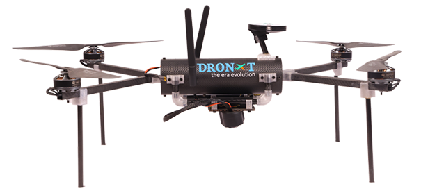
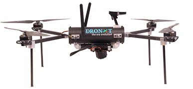
Dronxt | Drone Services in Sydney
You Will Love It.

The Era Evolution

Global View

Latest UAV technology and geomatics innovation to provide the most cost effective solutions.

Industry Experts

Meet our experts for your specific needs & ensure professional UAV data acquisition and analysis.

Renowed Ability

We are well known for our focus, innovation and ability to get the job done under complex environments.

Solutions

Dronxt's hardware and proprietary software enable applications ranging from surveillance and security

End to End Solutions

Rather than solving a part of the puzzle, Dronxt is focused on building end-to-end solutions for customers.

Scale of operation

Dronxt's experience manpower is helping to achieve high standards in terms of quality and operation.

About Quality

We're about Quality and Trust.

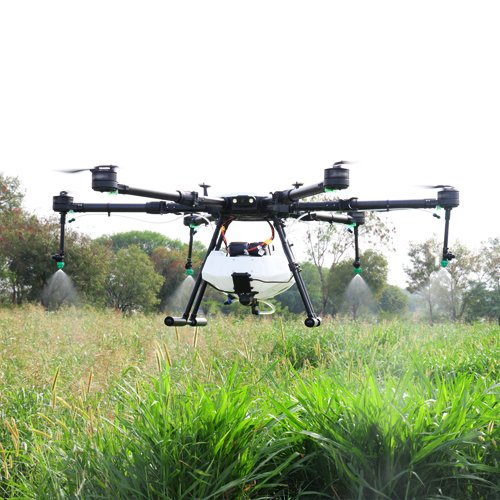
Dronxt the Era evolution is formed with a vision of creating new evolution in Intel and super inhuman effectiveness. it aims to enhance growth of drone’s sector globally in manufacturing innovative technology in both aerial unmanned and under water drones.

Read More

50

Satisfied Clients

2160

4K Resolution

45

Flight Time

120

Project done
All Products

Explore Our Products

Agricultural Drone

Agricultural drone technology is undoubtedly the future of the Indian agrarian community.

Read More

Logistics Drone

Industrial activities are advancing over the world as a result of cutting-edge technology.

Read More

Surveillance Drone

Rodnxt-S6, the first flagship multirotor UAV developed by Dronxt for surveillance missions

Read More

VTOL Fixed Wing

Our VTOL drone is significantly more suited for travelling great distances quickly and for longer periods of time.

Read More

Underwater Drone

Underwater drones of today can stay on station for longer periods of time, dive deeper, and send real-time footage for study.

Read More
About Service

Best Solution From Best Experts

Faster Data Acquistion

With our team of experienced drone pilots and with survey grade drones we collect aerial data 10x faster than our competitors.

Surveying / Mapping

Our tailored service of drone surveying enables us to procure precise topographic maps and 3D models of areas with unaccessible evidence.

Faster Delivery

We have team of GIS experts working around clock to process and analyse the Drone survey data to deliver on or before time.

Effective Analysis

Our team of highly experienced GIS Engineer, Drone Pilots and Software Engineers working around the clock to provide you with the best possible service experience.

One To One Support

One To One Support

From start to finish of project, we provide all possible support to our clients and help them in better decision making with Survey data.

Advance Equipment

Our surveying Drones are high-end and equipped with high resolution sensors for superior data quality. We use both DJI and Custom made drones for surveying.

<
Client Feedback

What Some People Say About Us.